,

How we obtain planning permission for an extension to a listed building
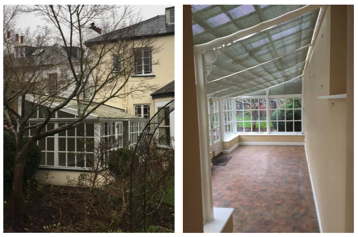
St Leonards, Exeter

The Brief:

  • The client requested a major ground-floor extension, replacing the conservatory and bay window, extending into the garden and creating an extended kitchen and living space

The Problem:

  • The property is a listed building within a unique style of buildings in the area.
    • Regency style architecture – spanning the first 30 years of the 19th century and showing a natural progression from the Georgian style that preceded it
  • There was a need to ensure that the new extension did not obstruct the light to the neighbours property

The Solutions:

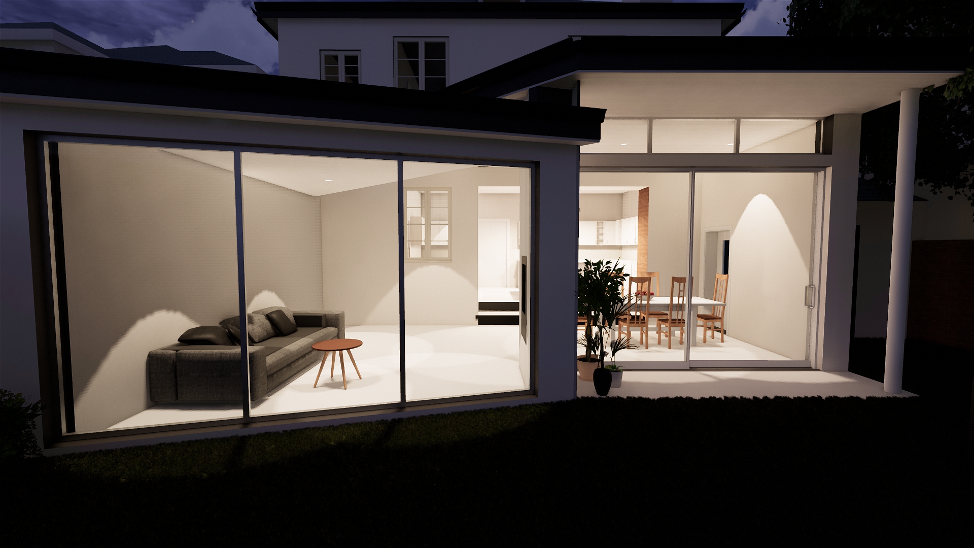
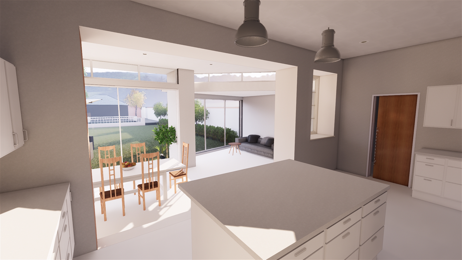
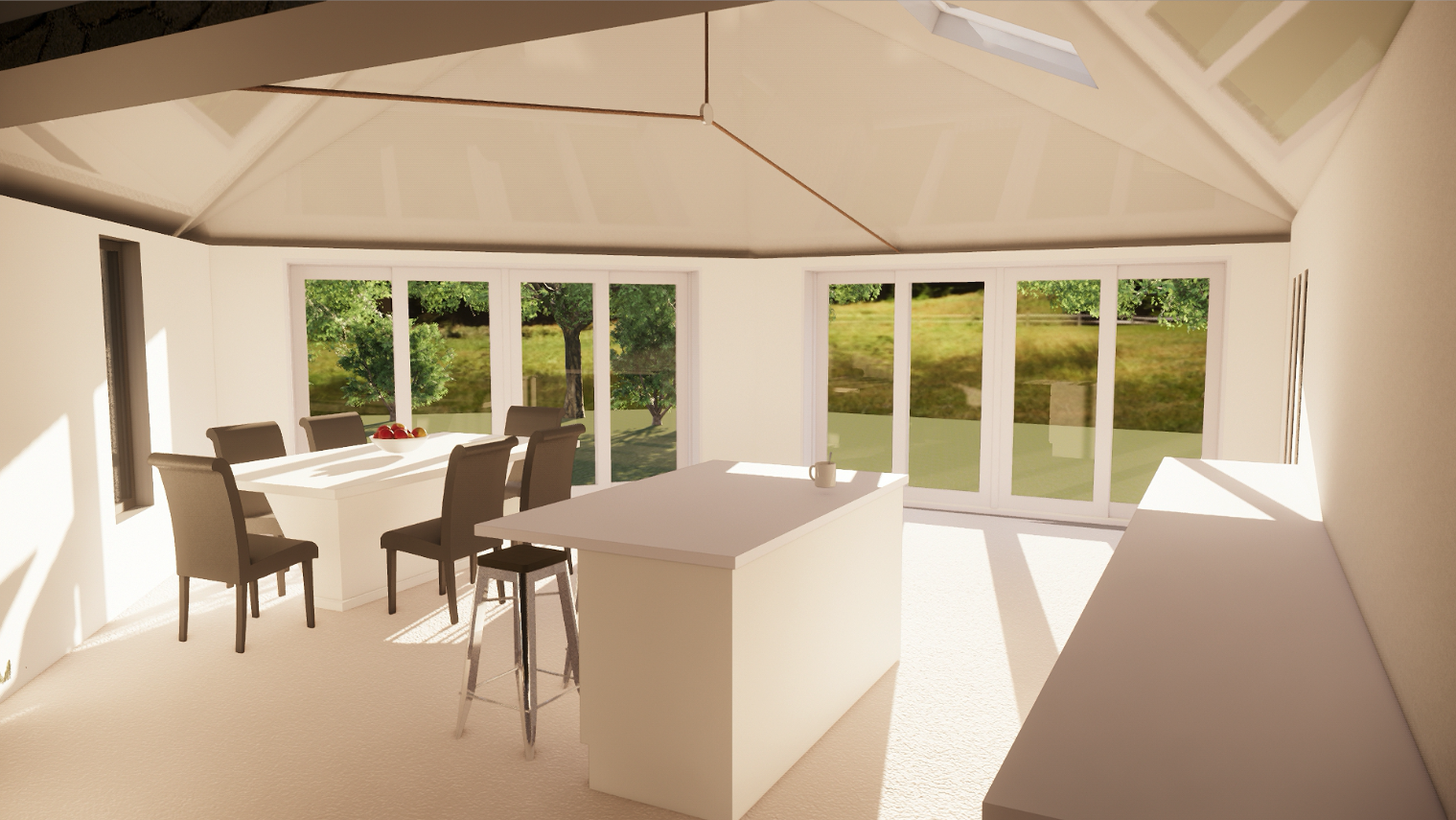
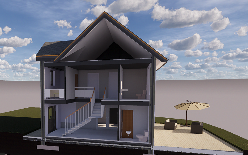
  • The pictures below show a “butterfly roof” whereby the 2 sections of the roof (one slightly raised with a gap between them) allow light into the extension itself as well as not obstructing light to the neighbouring property.
  • Having a very positive relationship with the planning officers meant that collaboration and feedback from them was able to be taken into careful consideration and implemented in our design.
  • The extension is very contemporary and contrasts to the Regency style architecture surrounding it. This is key to the design as it allows us to tell a story of the time period through architecture.

Pictures of the final drawings:

,

What are the benefits of using 3D scanning and point cloud integration in architectural work?

A point cloud is a set of data points in space. Point clouds are generally produced by 3D scanners, which measure a large number of points on the external surfaces of objects around them.

Living Space Architects have become one of the only architects in Exeter using this new technology.

Example of a point cloud of a model Stegosaurus

How does the 3D scanning work for buildings?

Using the ReCap Pro mobile app, the scanner streams the image and point cloud data to the iPad. The app filters and registers scan data in real time. After capture, ReCap Pro enables point cloud data transfer to a number of applications. The integration of BLK360 and Autodesk software dramatically streamlines the reality capture process.

Leica BLK360 Scanner in action

CLICK HERE – Point Cloud Video


What are the benefits of using this cutting edge technology?

  • It provides immediate 3D data for all our design drawings
  • It creates virtual reality images that we can immediately begin work on
  • The detail and accuracy of the images produced are second to none
  • The process of gathering information from the site is much easier and quicker

The results

By uploading the scans into Recap Pro, we can then create the existing 3D model. Here are some examples: